PID000149_Turkey_Nemrut-Dag_2013_05_Statue-Heads-at-Hierotheseion-of-King-Antiochos-I-of-Commagene-Banner-Page-1920x600

  SHARE

ONLINE RESOURCES

ASOR Map Collections

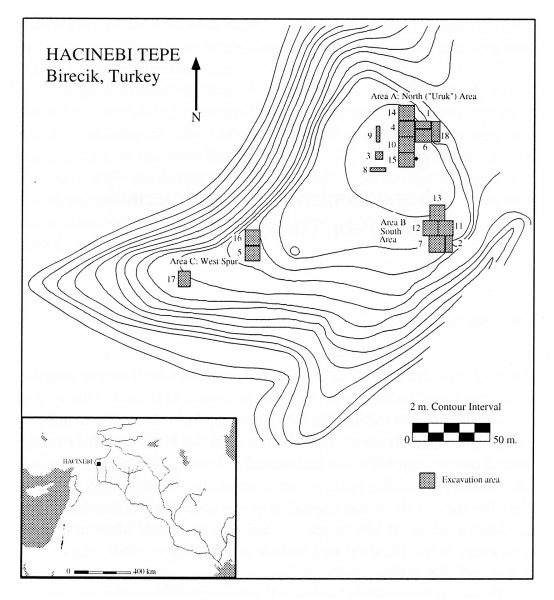
mid000042_Turkey_Hacinebi_2005_site-topo-map
Map ID: MID000042 – Download Image

Hacinebi, Turkey: Site Topographic Map

Country: Turkey
Location: Hacinebi
Description:
Hacinebi – topographic map showing excavation areas
Category: Maps, Archaeological Site
Type: Topographic Maps
Period:
 ChalcolithicEarly Bronze Age, Persian
Date: 5500 – 2000 BCE , 550 – 330 BCE
Credit: Gil J. Stein, 2005

Back to Browsing Locations in Turkey

Back to Browsing Maps

BROWSE THE PHOTO COLLECTION BY:
Country | Period | Category

If you would like to contribute to the ASOR Photo Collections or have any questions, please contact Marta Ostovich (programs@asor.org).

All images within the ASOR Photo Collection are licensed under CC BY-ND 4.0.