


New ASOR-Affiliated Projects: May 2025
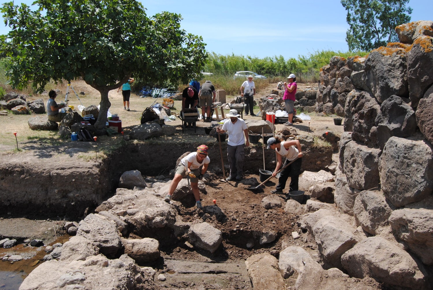
Fieldwork at S’Urachi in 2017
The S’Urachi Project investigates how the Indigenous Nuragic inhabitants of Iron Age Sardinia coped with Phoenician and subsequent Carthaginian influence, trade and colonization across the first millennium BCE. Long-term excavation at nuraghe S’Urachi on the central west coast of Sardinia offers detailed insights into how Indigenous communities and local households coped with these changes and adapted innovations to their own preferences.
The S’Urachi Project operates with a renewable three-year permit of the Italian Ministry of Culture and in close coordination with its regional office (Soprintendenza archeologica) in Cagliari (Sardinia, Italy). The project works closely with the town of San Vero Milis, who hold the project’s permit and appoint the project’s co-directors, Dr. Alfonso Stiglitz (director of the local Museo Civico) and Prof. Peter van Dommelen as the academic directors (direttori scientifici). The project is committed to prompt publication and public dissemination in multiple languages. The project website is bi-lingual and hosts (under ‘reports’) both yearly annual reports in Italian and a full list of its publications since 2012; the latter are mostly in Italian and Spanish and open access.
Humayma Excavation Project, Jordan (Craig A. Harvey, Sarah E. Wenner)
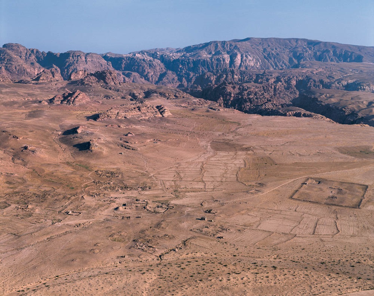
Aerial view of Humayma. Photo by Jane Taylor
The archaeological site of Humayma is located in southern Jordan, approximately equidistant between Petra and Aqaba. Founded by the Nabataean peoples in the 1st century BCE to control communication and trade in the heartland of the Nabataean Kingdom, Humayma became home to the earliest Roman fort in the region following the kingdom’s annexation in 106 CE. The site thrived economically throughout the Roman and early Byzantine periods, as demonstrated by the presence of no less than five churches from this time. In the early Islamic period, Humayma rose to global significance as home to the Abbasid dynasty before its overthrow of the Umayyad Caliphate in the 8th century. The sustained prosperity of this site throughout its occupation demonstrates the proficiency of local inhabitants to effectively exploit their surrounding landscape and leverage the strategic location of Humayma as a nexus of regional and long-distance trade and communication.
This project represents a renewal of archaeological investigation at Humayma, which will build on the success of previous work at the site. Preliminary goals of the first three seasons will be the creation of a high-resolution map of the site and investigation of its economic development from the Nabataean to Islamic periods, particularly regarding local resource extraction and use at the site.


Crafting Landscape: Resources Exploitation and Production Strategies in Iraqi Kurdistan during Urbanisation and State Formation (CraftLand), Iraq (Claire Padovani)
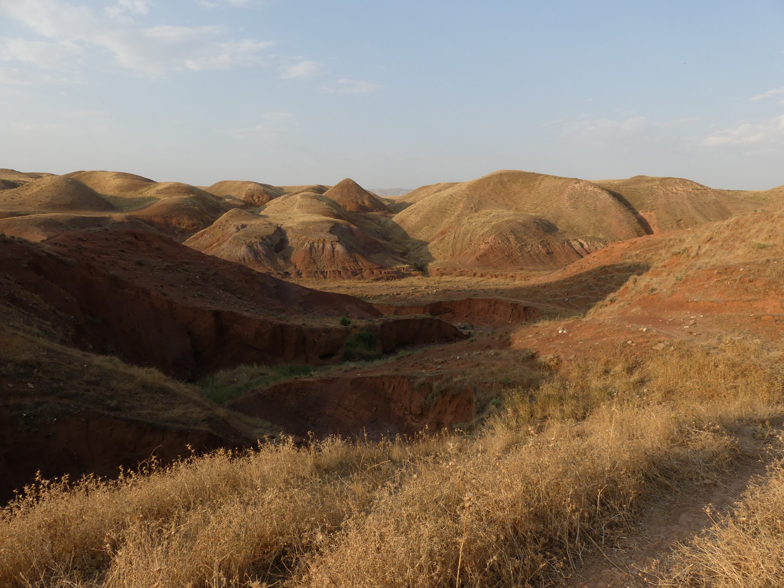
Landscape of the Qara Dagh foothills (Iraqi Kurdistan) © CraftLand
The CraftLand project investigates resource exploitation and production networks in the Kurdistan Region of Iraq, focusing on a clay-rich area between Sulaymaniyah, Chamchamal and Sangaw. Recent excavations in this area revealed large-scale pottery workshops dating to the 4th and 3rd millennia BCE. Moreover, the region has witnessed recurrent developments of intensive ceramic productions up to the present day, suggesting the presence of natural and social conditions favorable to the establishment and sustainability of a pottery-based economy.
The project adopts a bottom-up approach to the study of early economies in a “rural” region, offering a fresh perspective on local impacts of Mesopotamian urbanisation and State formation. It will reconstruct production networks and resource exploitation strategies, in order to assess patterns of landscape use that supported the operation of extensive pottery production. Craftland integrates multiple disciplinary perspectives, combining environmental, archaeological, and ethnographic studies. The research methodology includes geomorphological and geological surveys, satellite imagery, targeted field interventions (micro-surveys and test excavations), archaeometric analyses, and interviews with local potters. In addition, CraftLand contributes to cultural heritage preservation by documenting endangered artisanal traditions and fostering local engagement in the study and conservation of ancient craftsmanship.
Bioarchaeology of Syedra: Reconstructing lived experiences through human skeletal remains at Syedra Antik Kenti (Syedra Archaeological Site), Alanya Province, Turkey (Kathryn Marklein, Ertug Ergurer)
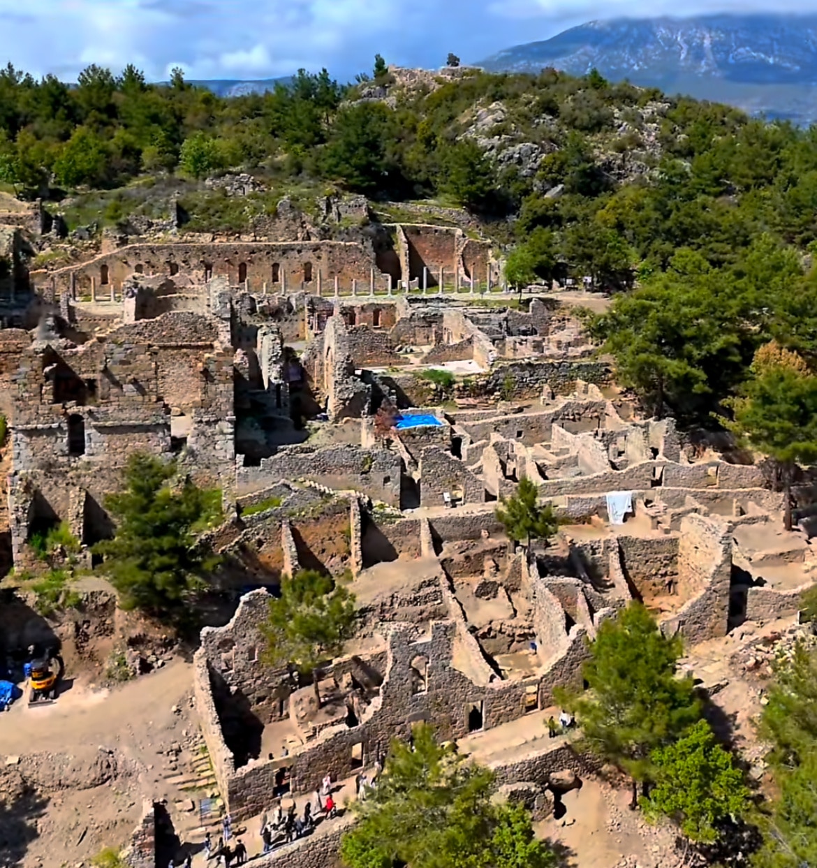
An overview of Syedra
What happens to people and communities when empires “fall”? The “Bioarchaeology of Syedra” project seeks to understand how the political transition from the Roman to Byzantine Empires impacted the sociobiological, cultural, and epidemiological landscape of ancient Syedra, Turkiye. A vital coastal economy in the Roman period (2nd-4th c. CE), this city transformed during the Byzantine period (11th-12th c. CE). Current excavations of the site have revealed multiple Byzantine burial grounds as well as extramural Roman tombs. Implementing methods and datasets from ancient DNA, paleopathology, and mortuary archaeology, the broader bioarchaeological research project aims to identify: 1) (dis)continuity in population structure between periods, as assessed through genetic diversity and kinship; 2) analyze transitions in cultural beliefs, as assessed spatially and materially in Roman and Byzantine period cemeteries; and 3) contextualize biological stress and resilience, as assessed through demographic and paleopathological data. Bioarchaeological fieldwork will include the excavation of Roman and Byzantine graves, processing of human skeletal remains post-excavation, and preliminary osteobiographical analyses of skeletons. The “Bioarchaeology of Syedra” is part of the larger Syedra Antik Kenti Archaeological Site, under the auspices of the Turkish Ministry of Culture and Tourism. This excavation seeks to 1) uncover the Roman period city to better understand its place in the Roman and later Byzantine Empires; 2) increase local and international interest in archaeology and history; and 3) preserve the site for local and global cultural heritage.
The Promontory Palace Project at Caesarea Maritima, Israel (Barbara Burrell, Kathryn Gleason)
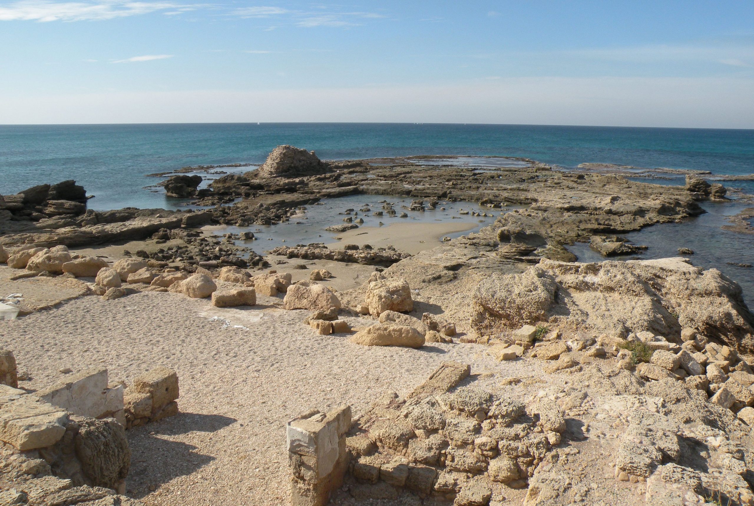
The Promontory Palace. Photo by Barbara Burrell
The Promontory Palace, first identified by Ehud Netzer as that of Herod the Great, is built out into the Mediterranean Sea, just west of the theater in the SE area of Caesarea Maritima. Initially, the lower palace was constructed for Herod to plan and supervise the great harbor, and the palace was extended later in his reign to provide reception space for guests at spectacles and official functions. On his death, the palace served as the official praetorium of his heirs and subsequent Roman officials for centuries. Lower Promontory Excavations in the 1970s by Netzer and Lee I. Levine in the lower area of the palace revealed a series of luxurious reception rooms and heated chambers centering on a large (35 x 18 m.) rock-cut swimming pool enclosed by a colonnade. Cuttings in the bedrock between the columns suggested to Netzer that planters had been built between the columns, offering a pluteus around the pool, as well as the effect of a garden for swimmers in the pool. The Upper Palace Excavations were undertaken by K. Gleason and B. Burrell for the University of Pennsylvania Museum (1990-1996), in collaboration with Netzer and Hebrew University.
The project is now in the final stages of publication by Burrell and Gleason for the University of Cincinnati and Cornell University, respectively, together with Lisa Kahn, co-editing the Finds Volume. Although the building was thoroughly looted over the centuries, the project is providing an exceptional insight into the transition of an official residence from Hellenistic basilaea to Roman praetorium in terms of architecture and material culture. The project has also made contributions to the environmental archaeology of maritime villas, to the study of ceramic building materials, to the corpus of defixiones (curse tablets). The publication will comprise two volumes and an open access database of the excavation’s stratigraphy and finds.
Nineveh East Project, Iraq (Timothy Harrison, Khaled Abu Jayyab)
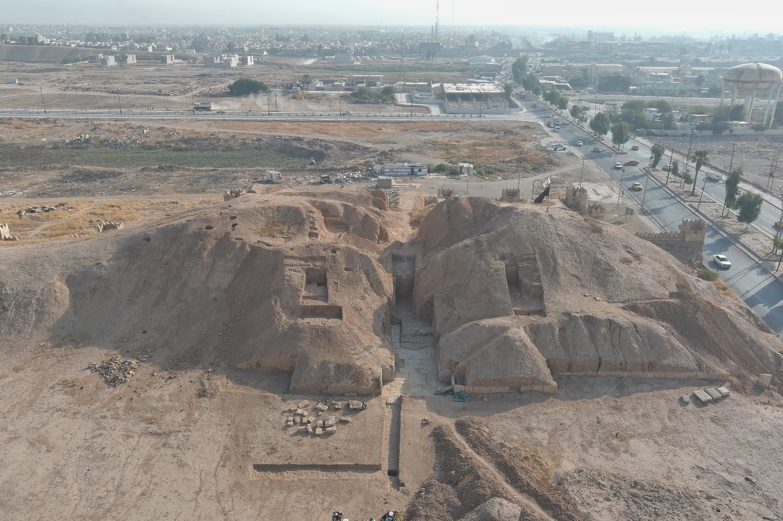
An overview of eastern Nineveh
The Nineveh East Project, a collaboration between the Iraqi State Board of Antiquities and Heritage (SBAH) and the Institute for the Study of Ancient Cultures (ISAC), University of Chicago, focuses on assessing damage, restoration, and scientific excavations at Nineveh following extensive destruction during ISIS’s occupation of Mosul (2014-2017). Efforts are centered on eastern Nineveh, which includes the city’s expansion under King Sennacherib (705-681 BCE). The project began work at the Shamash Gate in 2020 under the Joint Iraqi-Italian Expedition to Nineveh. One of the largest gates along Nineveh’s eastern wall, the Shamash Gate sustained severe damage due to tunneling by ISIS, which destabilized its structure. While the core structure of the gate remained largely intact, ISIS tunneling within the gate has led to its destabilization.
Between 2021-2024, operations that encompassed stabilization, excavation, and restoration took placed led by Dr. Timothy Harrison and field director Dr. Khaled Abu Jayyab. The primary objectives included stabilizing the gate by reinforcing and filling the tunnels, the systematic removal of debris from the 612 BCE destruction of Nineveh, and the delineation of tower chambers within the gate. Starting in 2025, work will expand across eastern Nineveh to investigate post-Sennacherib urban development while continuing restoration efforts. This new phase includes collaboration with the local municipality to develop public spaces, reinforcing Nineveh’s significance as a landmark in East Mosul. Additionally, these efforts aim to support tourism infrastructure by integrating archaeological heritage into the city’s cultural and economic future.