2024 Shepard Urgent Action Grant: Rescue Excavation of a Chalcolithic Settlement in Southwest Georgia
Gia Chilingarashvili, Ivane Javakhishvili Tbilisi State University and Georgian National Museum
Thanks to a 2024 Shepard Urgent Action Grant, our project team conducted a 20-day small-scale excavation at a recently discovered Chalcolithic site in the village of Pkhero in southwest Georgia. This site has suffered damage from both natural and human activities. Urgent excavations became necessary after a portion of the settlement was destroyed during road construction, resulting in a 1-2-meter-high section that continued to collapse periodically. Ongoing erosion, exacerbated by heavy rainfall, threatened to destroy the remaining archaeological layers. Immediate intervention was essential to prevent further loss of the settlement.
The aim of the rescue operation was to collect primary data to determine the nature of the monument by examining its stratigraphy and collecting samples. This data will enable us to develop a long-term strategy for research and conservation of the site. Additionally, the results will help us implement plans to protect the site from further damage.
Archaeological sites from the Chalcolithic period are extremely sparse in Georgia. This site holds significant scientific potential for understanding various aspects of late prehistory in the South Caucasus. The settlement’s location is noteworthy, as it is situated near the Persati Plateau, an alpine pastoral zone that serves as one of the region’s primary pastures and economic resources. Geographically, this area represents the only natural pathway connecting the still-active alpine pastures (Fig.1).
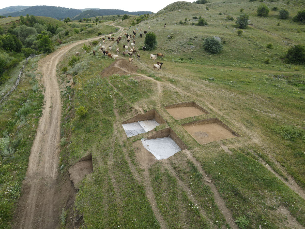
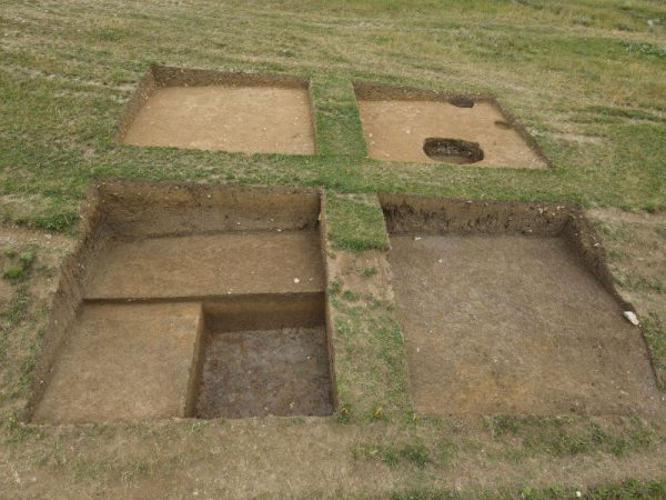
According to the plan, a 10 x 10-meter trench designated as E3 was excavated in the selected area and divided into four equal squares by 1-meter-wide bulkheads. In square E3.2, a classical pit and two early medieval pits were uncovered near the surface, containing an abundance of pottery sherds.
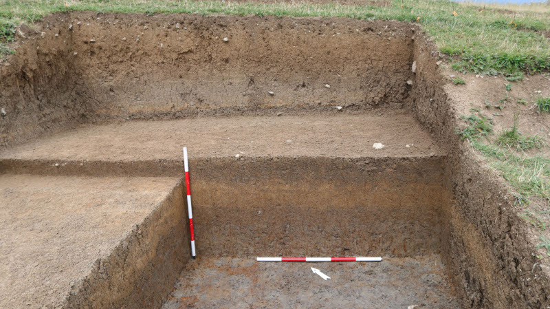
After 20 days of fieldwork, we determined that the site features clay layers measuring 3 meters in height, overlaying the Chalcolithic horizon. Evidence of subsequent activities from the Classical and Medieval periods is present within the upper levels of this clay (Fig.2). The genesis of the intense clay remains unclear; however, stratigraphy indicates that sedimentation occurred repeatedly over time. The alternating loam layers vary in color, and in some cases, they are separated by thin, brownish granular layers (Fig.3). This suggests that accumulation was not a one-time event and likely occurred after the Late Chalcolithic, rather than before the Classical era. Samples from each clay layer were collected for sedimentological and palynological analysis.
It is important to note that the clay sediments were not sterile. Even at a depth of 2 meters, they contained abundant charcoal inclusions, along with a small quantity of obsidian fragments and ceramic sherds. This trench reached a maximum depth of 2.5 meters in square E3.3, and we were unable to access the Chalcolithic layer due to the thickness of the clay and time constraints. It can, however, be assumed that the Chalcolithic layer does exist beneath it, and that activities from later periods did not penetrate down to this layer.
This assumption is supported by two small trenches (N1 and N2) located adjacent to the main excavation, positioned above an artificial cut associated with road construction (Fig.4). The purpose of excavating these features was to investigate the disturbed pits containing prehistoric material observed in the profile.
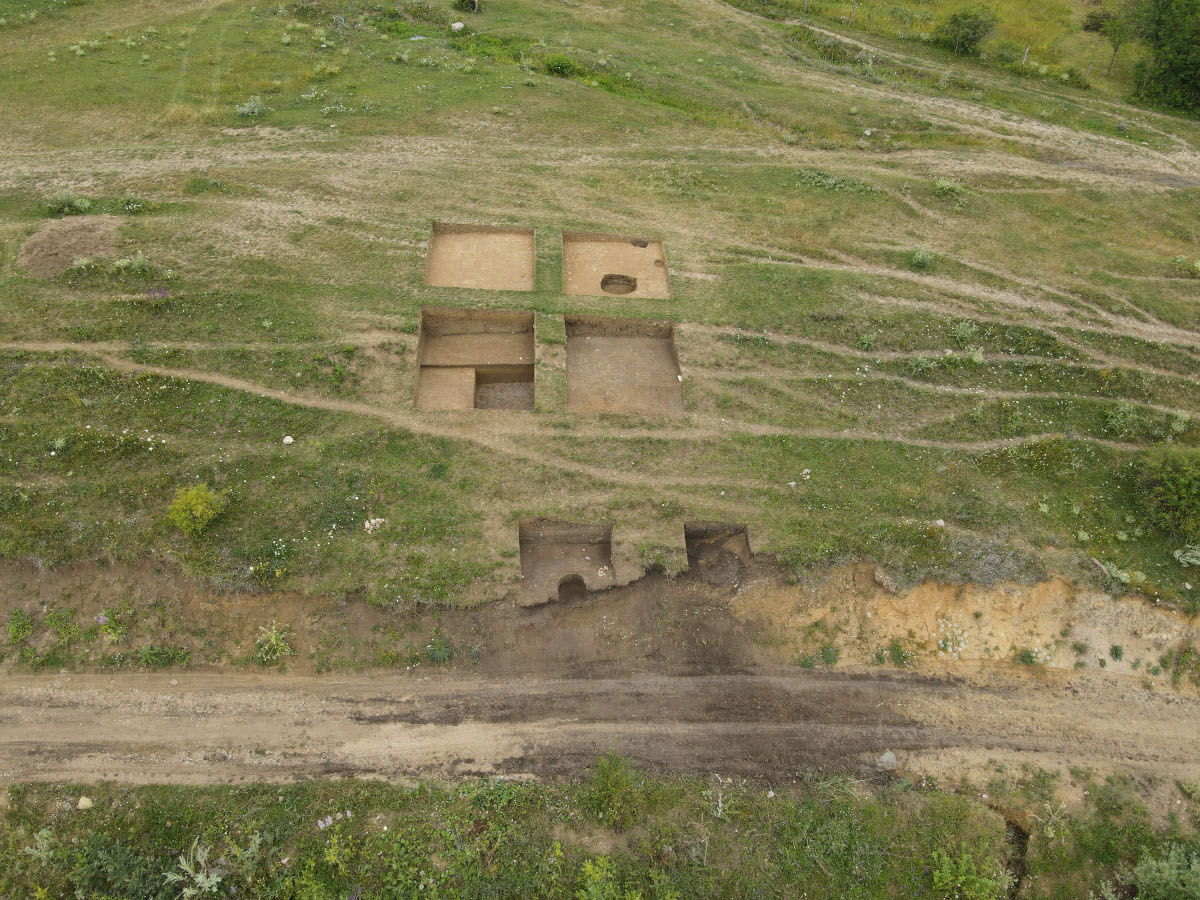
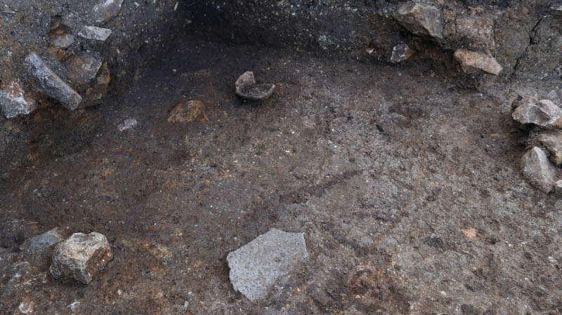
In the small trenches located approximately two meters from the main excavation, we confirmed the presence of the Chalcolithic layer. This layer contained a substantial amount of archaeological material, including a small vessel and a grinding stone, both of which were recorded in situ in Trench N1 (Fig.5). Although the context of these findings remains unclear, the associated feature extends into the unexcavated area toward Square E3. We did not widen the trench, as the primary focus was a half-destroyed pit, the excavation of which yielded a wide variety of materials. In the second trench, a Chalcolithic pit was identified, along with an intensive cultural layer that extends beneath the clay deposits toward Square E3.
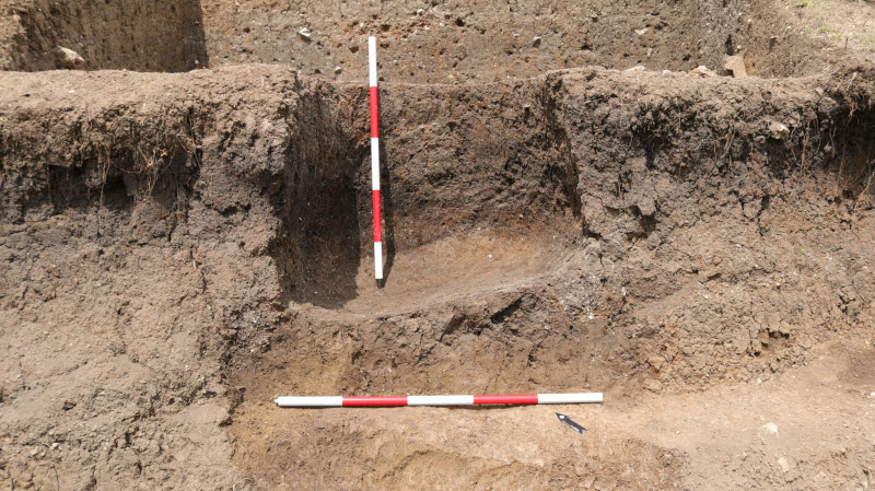
During our work in the Chalcolithic layers, we noted that all layers from this period, including those within the pits and the bottoms of the pits, slope toward the west (Fig.6) It is noteworthy that the clay layers above and the later pits do not exhibit a similar slope. This noted slope is attributed to a natural event that occurred in the late prehistoric period, which caused the settlement to incline toward the west. This event may have contributed to the abandonment of the settlement.
In summary, our excavation has yielded valuable insights into this significant Chalcolithic site. Moving forward, the analysis of the collected materials will enhance our understanding of late prehistory in the South Caucasus.
Established in 2020 with annual contributions, the Shepard Urgent Action Grants program was created to support emergency and rapid response activities on archaeological sites in the greater Mediterranean region. Shepard Grants have provided over $74,000 in support of projects with urgent need since the program began. While preference is given to projects and teams with current ASOR affiliation, applications will be considered from all projects. All 2024 grant funds have been awarded, and pending the receipt of funds, ASOR plans to resume accepting applications for Shepard Grants in 2025.
Read more about the grant program here.
Latest Posts from @ASORResearch
Stay updated with the latest insights, photos, and news by following us on Instagram!
American Society of Overseas Research
The James F. Strange Center
209 Commerce Street
Alexandria, VA 22314
E-mail: info@asor.org
© 2023 ASOR
All rights reserved.
Images licensed under a Creative Commons Attribution-NonCommercial-ShareAlike 4.0 International License
COVID-19 Update: Please consider making payments or gifts on our secure Online Portal. Please e-mail info@asor.org if you have questions or need help.
