
New ASOR-Affiliated Projects: May 2024
Currently, 137 projects are affiliated with ASOR. This includes 108 field projects and 29 publication projects. Seven new projects have received ASOR affiliation since last summer. Read more about these new ASOR-affiliated projects below!
ASOR-affiliated projects adhere to ASOR policies, most notably the Non-Discrimination Policy, Policy on Professional Conduct, and Code of Conduct for the ASOR Annual Meeting and Other ASOR Sponsored Events. These policies affirm ASOR’s commitment to high standards for research integrity, academic mentoring and ethical professional behavior. Project Principal Investigators may apply for ASOR affiliation for their projects through the Committee for Archaeological Research and Policy (CAP). Principal Investigators of ASOR-affiliated projects are eligible to apply for ASOR Project Grants and Shepard Urgent Action Grants. Students working on ASOR-affiliated projects are eligible to apply for Scholarships for Fieldwork Participation.
New ASOR-Affiliated Projects
Paths to Urban Growth in the Nineveh Plain (PUG), Tepe Gawra and Tell ‘Arna/Gogjeli, Iraq (Khaled Abu Jayyab)
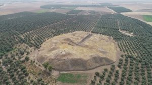
Aerial view of Tepe Gawra.
Paths to Urban Growth in the Nineveh Plain (PUG) explores the origins of early urbanism in Northern Iraq during the 5th and 4th millennia BC through excavations at the sites of Tepe Gawra and Tell ‘Arna/Gogjeli. Tepe Gawra has been the hallmark site for the development of complexity during the Ubaid and Late Chalcolithic periods in the ancient Near East. Past excavations at the site revealed a local development of a sophisticated infrastructure manifest in construction of temples, monumental architecture, and elaborate administrative technologies. Due to these features, Tepe Gawra has been characterized as an administrative centre atop of a regional polity. However, recent survey carried out by our team at Tepe Gawra has identified the presence of a lower town, potentially indicative of the presence of domestic occupation. Further, due to the lack of excavated sites of the same time period in the surrounding region, it is difficult to determine if the features identified at Tepe Gawra are unique, or if the features that characterize it are common at other sites in the Nineveh Plain, such as Tell ‘Arna/Gogjeli. Excavations at Tell ‘Arna/Gogjeli allow us to compare the processes occurring at the two sites, test regional assumptions on the centrality of Tepe Gawra, assess networks of interactions within the region, and build a more complete picture on the process of urban developments in northern Iraq.
A Clash of Kings — South-central Anatolian political geography between Phrygia and Assyria, Cappadocia, Turkey (Michele Massa)
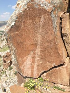
Carved depiction of Great King Hartapu, who ruled in the 8th century BCE in the Konya Plain.
This three-year project aims to reconstruct the political geography of the Tabalian confederation, a group of small kingdoms in south-central Anatolia (Türkiye) that existed during the late 9th-early 7th centuries BCE squeezed in between the two major powers of the time, Phrygia and Assyria. While we have extensive written sources (including Assyrian annals and local Luwian monumental inscriptions) and significant archaeological data (excavated and surveyed settlements and forts, landscape monuments) covering this period, very little interdisciplinary research has been done to synthesize them into a coherent picture.
Our goal is to reassess this varied evidence within an integrative analytical environment where we can combine conceptual frameworks and methods stemming from history, philology, landscape archaeology and digital archaeology. We plan in particular to (a) create high-resolution 3D and RTI models of key Luwian inscriptions; which in turn (b) provide improved translations of these monuments, particularly those shedding light on relations between different Tabalian rulers; and (c) integrate textual-borne evidence with a GIS-led analysis of human and natural landscapes to sketch the diachronically changing Tabalian power networks and map them onto real-world geographies.
Cadır Höyük Archaeological Excavations, Turkey (Sharon Steadman, Jennifer Ross, Burcu Yldr)
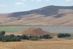
Cadır Höyük.
Çadır Höyük is located on the north central Anatolian plateau. There has been continuous occupation at Çadır for at least 6,000 years (late 6th millennium BCE to the 13th century CE). Excavations commenced in 1994, continuing to the present time. Steadman is the fourth project director, preceded by Gorny (1994-2009), McMahon (with whom she co-directed, 2010-2019), and Şerifoğlu (2020-2021). Excavations include (trenches are 10 x 10 m): ten trenches exposing the Chalcolithic occupation (lower S slope); over ten trenches dedicated to Byzantine occupation (summit); six trenches focused on Hittite/Bronze Age occupation (N and E slope); four trenches dedicated to the Iron Age (various areas); previous excavations and a few current trenches having investigated the Classical/Hellenistic periods.
We have a housing/research compound which comfortably houses 30 people. A four room-lab provides ample research area. A newly-built conservation lab is separate. We have a two-room equipment storage facility, and a three-room storage depot for archaeological materials. A guard lives at this compound year-round.
Our senior research team has been with the project for a decade or more. Each year we train undergrad/grad students, from Türkiye and elsewhere, in field and lab methods. We have a strong and inclusive publication history.
Horvat Midras Excavation Project, Israel (Orit Peleg-Barkat, Gregg E. Gardner)
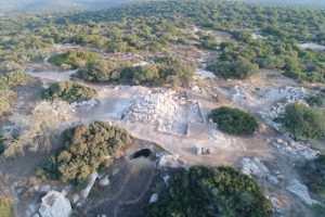
This project aims to enhance our understanding of rural life in the Southern Levant by excavating Horvat Midras, Israel, the site of an ancient village with several phases of occupation over two millennia. We are especially interested in understanding the village’s social and religious character, how it changed, its daily life, and the impact of military conflicts, migration, and resettlement efforts. Located between Jerusalem and the Mediterranean coast, in the Shephelah or Judean Foothills region, Horvat Midras was inhabited by several different groups from the 4th century BCE to 16th century CE, including Idumeans, Jews, Roman polytheists, Byzantine Christians, and Muslims under the Umayyads, Mamluks, and Ottomans. Our initial surveys and excavations suggest that the site was profoundly transformed following the Roman suppression of the Second Jewish Revolt in 132-136 CE, which was followed by Roman resettlement of the village and construction projects that would have an enduring impact. This project began in 2015 with the Hebrew University of Jerusalem’s Institute of Archaeology and since 2018 has been a joint-venture together with the University of British Columbia (Canada).
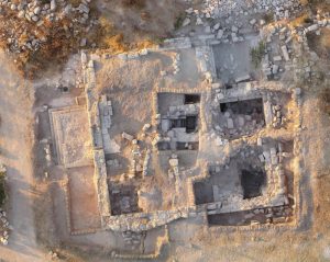
Exploring Continuity and Transition in Southern Jordan (Jennifer Ramsay, Bjorn Anderson, Craig Harvey)
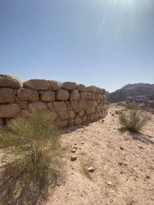
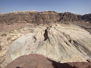
The Exploring Continuity and Transition in Southern Jordan (CTSJ) project is a multi-disciplinary group of American and Canadian collaborators that plan to conduct a survey focusing on sites previously identified as having evidence of multiperiod occupation between Petra and Humayma in southern Jordan. The main aim of this survey is to investigate these archaeological sites for signs of continuity or shifts in cultural practices over time, specifically between the Iron Age and the Nabataean period. While several sites in the region have undergone preliminary surveys noting material culture from various periods, only a few have been extensively excavated. Many of the sites identified have very limited information and no chronological verification from excavations. Therefore, our primary interest lies in enhancing our understanding of Nabataean prehistory, particularly regarding cultural activities (ritual, funerary, agriculture, engineering) during the Iron Age and their continuity or transition into the Nabataean period. There is a significance gap in our understanding of this period (approx. 539-300 BCE) in the prehistory of Jordan, which needs to be addressed. A review of published archaeological findings in the area has revealed this gap in our comprehension of this period, which has prompted new research inquiries that can only be addressed initially through a survey of specific sites in the region.
University of Palermo Archaeological Research Project at Motya (Sicily), Italy (Paola Sconzo)

Island of Motya.
Since 1977, the University of Palermo has led research at the site of ancient Motya, an island city in western Sicily founded by Phoenician colonists in the 8th century BCE that grew into a strategic Carthaginian center. This project made several noteworthy contributions to the scholarship of the Mediterranean in its early years, including the documentation of a large pottery workshop that features kilns of Levantine tradition and the revelation of the world-renowned “Youth of Motya” statue, a mid-5th century BCE masterpiece crafted of Parian marble. After 2013, the Palermo Archaeological Mission has grown to become a multinational project with active collaborations with the University of Pennsylvania and the University of Tübingen. Current research foci at Motya include the excavation of pre-Phoenician contexts to understand Bronze Age land use and settlement, excavation of Punic monumental buildings and public spaces, excavation of the archaic necropolis coupled with bio-archaeological and genetic research, and extensive geophysical prospection, surface survey, and test excavations to understand the development of Motya’s urban structure and changes in the ethnic identities of its residents over time. These ongoing research efforts are integrated with education including a field school where students from the University of Palermo and elsewhere come together to gain experience in all facets of archaeological fieldwork.
The Sebittu Project at Sebittu Cluster (Erbil Plain), Iraq (Timothy Matney)
The Sebittu Project is a long-term study of the agrarian economies and environmental impacts of imperial expansion during the Iron Age of Iraqi Kurdistan. Centered on a cluster of seven villages, hamlets, and farmsteads in the Erbil Plain, the Sebittu Project looks at Neo-Assyrian imperial economy through a “bottom-up” perspective. The Sebittu Project focuses on the collection and intepretation of paleobotanical, zooarchaeological, and environmental data from primary contexts to address broad research questions regarding models of Assyrian imperial expansion, internal organization of agrarian settlements, regional economies, paleoenvironment conditions, and human impacts on the landscape.
American Society of Overseas Research
The James F. Strange Center
209 Commerce Street
Alexandria, VA 22314
E-mail: info@asor.org
© 2023 ASOR
All rights reserved.
Images licensed under a Creative Commons Attribution-NonCommercial-ShareAlike 4.0 International License
COVID-19 Update: Please consider making payments or gifts on our secure Online Portal. Please e-mail info@asor.org if you have questions or need help.