Geophysics in the Erbil Plain
Thank you to ASOR and Dr. Eric Meyers and Dr. Carol Meyers for allowing me this opportunity to participate in my first excavation! Without the Fellowship, I would not have been able to excavate in the Kurdistan Region of Iraq.
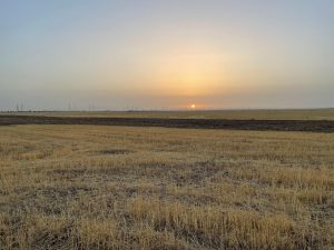
Fig. 1: Qach Rresh at sunrise. The slight outline of the mountains are visible in the distance. Photo courtesy of Sophie Vo.
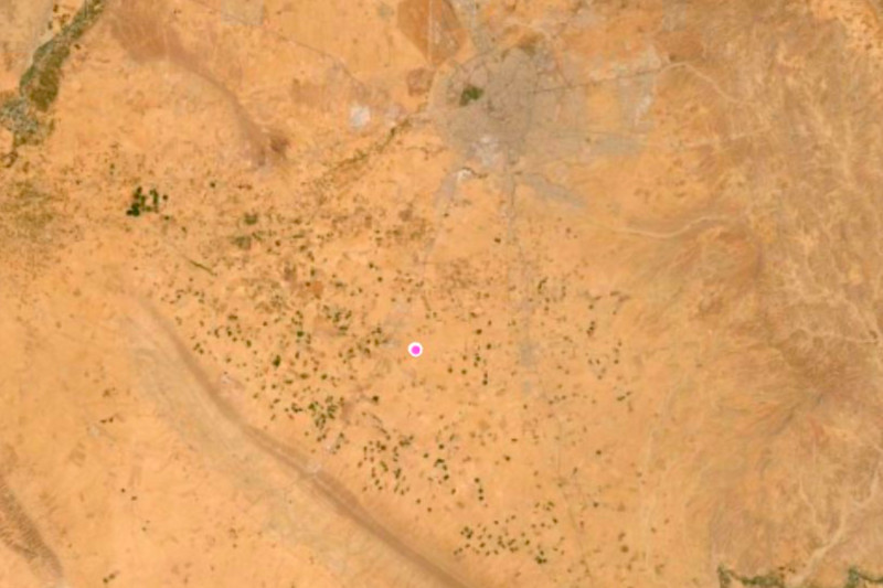
My mornings started at 3:30 am—I would wake up an hour before we departed to pack lunch for the team’s second breakfast or drink coffee and slowly transition into consciousness. At 4:30am, we would pile into our driver Bapir’s van. As the sun rose, we drove east from Ankawa, the Christian district of Erbil. Typically, we arrived at our site, Qach Rresh, at 5:30am. The sun was poking through the clouds and the air was still cool. Qach Rresh, located 14 km south of Erbil and 2 km north of Trpa Spiyan, is a site which is estimated to date to the 7th-4th centuries BCE (Iron Age II and III). This includes the height of the Assyrian Empire and its subsequent collapse, including periods during which the Erbil Plain might have been under Neo-Babylonian or Median control in the 6th century and Achaemenid Persian control thereafter. Later, the administrative buildings at Qach Rresh were apparently used as trash dumping grounds after the fall of the Assyrian Empire, giving us a huge amount of data about the 6th-4th centuries that is otherwise rare on the Erbil Plain.
Upon arriving at Qach Rresh, I would help Glynnis, the project registrar, set up the Emlid R2 GPS system and lay lines for magnetometry. Magnetometry is an archaeological survey method that measures the Earth’s geomagnetic field at the nanotesla (nT) level with two sensors spaced 1 meter apart. Archaeology does not solely involve digging and excavating on site. We would excavate in the mornings and perform data analysis, ceramic cataloging, and zooarchaeological analysis in the afternoons.
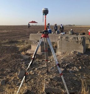
To record points in X-Y space, Glynnis and I set up the Emlid R2 GPS system, one of two Reach R2 systems (Figure 2). This allowed us to measure points with sub 2cm accuracy. The base RS2 sits stationary while the rover RS2 is moved to mark points. We marked points using this rover so that we could lay transect ropes every two meters for the magnetometer machine reading spaced every 50 cm (Figure 3). Figure 3 demonstrates the typical set up for surveying Qach Rresh using magnetometry.
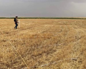
Fig. 3: Example of the magnetometry survey setup, with transect ropes set up every two meters for machine readings spaced every 50cm.
Afterward, Dr. Creamer showed me how to conduct magnetometry by carrying the Bartington 601-2 Gradiometer suspended from our backpack straps ~20cm from the ground surface. The left and right vertical sensors needed to be held parallel to each other and perpendicular to the ground. Transects were laid out at intervals of 2m in 20x20m squares (with machine readings at every 50cm),with corner stakes laid in by GPS (Emlid Reach R2). The machine took eight measurements at a pace of one meter per second walking speed. By the end of the day, we were all walking at a cadence of one meter per second and measuring distances by counting our steps. Each square took roughly 15-20 minutes to survey with the Bartington. On average, 5,600m2 (or, roughly half a hectare) was surveyed with the Bartington per day. In the lab, geophysics results were analyzed with the open source computer applicationArchaeoFusion. Magnetometry of the site revealed important features of the rural administrative center of the Neo-Assyrian Empire, such as an animal pen and other potential buildings for future field seasons.
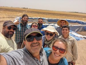
One of my favorite aspects of the Rural Landscapes of Imperial Iron Age Mesopotamia project was the ability to get my feet wet in the various sub-specialties of archaeology. I worked with Laurel Poolman, a zooarchaeology student, who taught me how to analyze and identify unearthed animal remains from our site. I also was able to work with the Kurdish workers, Hallo and Tayib, who taught me how to quickly and efficiently dig trenches. It was extremely valuable learning numerous archaeological methods, from learning the basics—like writing lot numbers—to interpreting animal remains and discussing magnetometer readings. As my first excavation, I gained valuable archaeology and professional experience both in and out of the field. I was also afforded the opportunity to explore my research interests and make lifelong friends on the project. I am extremely grateful to have met everyone in Kurdistan and I can’t wait to return next season!
Want to learn more? Visit the Project’s Website or ASOR’s TikTok and Youtube to hear about Sophie Vo’s field experience!
American Society of Overseas Research
The James F. Strange Center
209 Commerce Street
Alexandria, VA 22314
E-mail: info@asor.org
© 2023 ASOR
All rights reserved.
Images licensed under a Creative Commons Attribution-NonCommercial-ShareAlike 4.0 International License
COVID-19 Update: Please consider making payments or gifts on our secure Online Portal. Please e-mail info@asor.org if you have questions or need help.
