2022/2023 Mesopotamian Fellowship Report: The Excavations of Qach Rresh (First Season)
Petra Creamer, Emory University
I. Goals of the Excavations at Qach Rresh
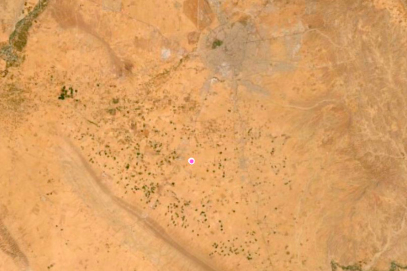
In the very first season of the Emory University excavations at the site of Qach Rresh, located just a few kilometers north of the village of Trpa Spiyan, the team was interested in investigating several questions:
- identifying the exact dates of construction and occupation of Qach Rresh
- understanding the function of the large buildings discovered in the magnetometry
investigations of 2022 - explore why such a site existed in a relatively marginal agricultural area
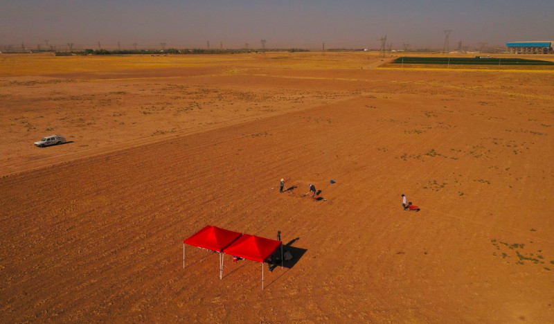
With a season lasting 5 weeks (from August 31 – October 2, 2022) and supported by the ASOR Mesopotamian Fellowship, the Emory team opened two trenches over the main building remains at Qach Rresh with the intent to begin answering these questions.
Manipulating the photograph using the Digital Epigraphy’s user interface produces the best known available photograph of the inscription. Compare the previously published photograph to that made during our cataloguing efforts.
II. Team Members of the Qach Rresh Excavations
Foreign Project Staff
- Prof. Petra Creamer, Emory University, USA (Project Director)
- Dr. Kyra Kaercher, USA (Assistant Director, Ceramicist)
- Dr. Nathalie Brusgaard, Groningen University, Netherlands (Zooarchaeologist)
- Dr. Elise Laugier, Rutgers University, USA (Micropaleobotanist)
- Dr. Lucas Proctor, Goethe University Frankfurt-am-Mainz , Germany
(Macropaleobotanist) - Ms. Glynnis Maynard, Cambridge University, UK (Excavator)
Kurdistan Region Project Staff
- Kak Ahmad Jodat, Erbil Antiquities, KRG (Project Representative)
- Kak Nader Babakr, Erbil Antiquities, KRG (Erbil Governate Director of Antiquities)
- Five workmen from Trpa Spiyan
III. Prior Research at Qach Rresh
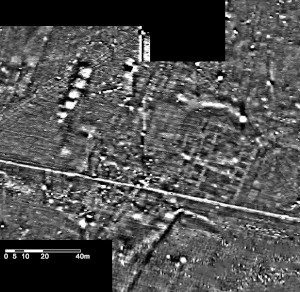
Qach Rresh was first discovered and recorded by the Erbil Plain Archaeological Survey (EPAS) in 2017 as a single-period Neo-Assyrian (Iron Age) site (EPAS Site Number 458). In 2021, EPAS returned to the site to conduct geophysical investigations with a Bartington 601-2 Gradiometer. The results showed the remains of several large buildings and smaller structures at the site (see Fig. 2).
These results showed an example of an unusual type of Iron Age site which had never been excavated before – a rural village, likely centered around agriculture. However, the presence of large buildings at the site was unexpected, raising questions of imperial involvement in agricultural production.
IV. Excavation and Recording Methodology
The scientific recording of the excavations at Qach Rresh were a combination of digital and traditional. In the field, the excavators would record all contexts and collection lots on paper worksheets, which would then later be entered into digital spreadsheets during lab time in the afternoons.
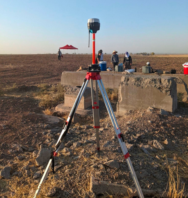
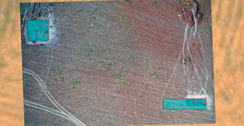
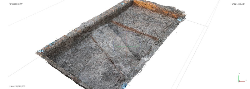
Spatial recording methods relied upon two Emlid-brand RTK GPSs (Real Time Kinematic Ground Positioning Systems). The setup of two Reach R2 systems (see Fig. 3) allows the user to record points in X-Y space with sub 2cm accuracy. The base RS2 sits stationary while the rover RS2 is moved to mark points. Using this, we were able to mark features of significant interest along the cut, as well as record the location of features within Operation A. These recorded points were then imported into ArcGIS to record the exact location of the features. GIS was a key component of the recording system, since the trenches and their related features could be recorded in real space for reference in this season and future seasons (Fig. 4).
VI. Interpretation
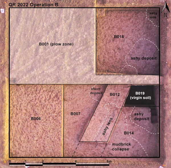
Both the buildings in Operation A and Operation B were difficult to identify based on excavation alone, due to significant deterioration in the mudbrick. By using the magnetometry data together with the excavation, we were able to come to several conclusions about the site after one season:
- Many of the artifacts collected from the Qach Rresh excavations likely date to the post-Assyrian phase of the Iron Age (c. 600-500 BCE). This is based on the post- Assyrian forms of the ceramics and the common use of grit instead of chaff as a temper.
- The rooms of Building B (in Operation B) were clearly used as a dump in the post- Assyrian period.
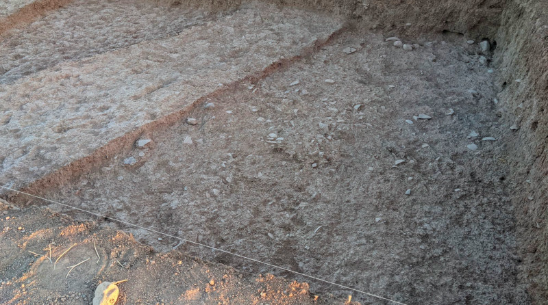
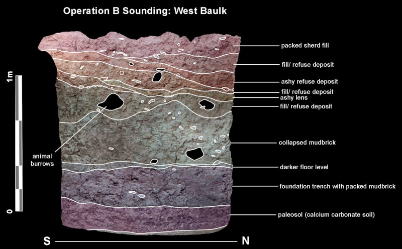
The room excavated in Building B this season contains at least 130cm of fill from trash deposition. Below these multiple deposition events (which can be identified in the stratigraphy of the baulk – see Fig. 12) there is what appears to be roughly 55cm of mudbrick collapse, likely from the roof of the building. Below this, there is a 30cm thick layer of hard-packed clay with very few artifacts. We interpret this layer to be the remains of the foundation trench constructed before Building B was built.
While initially we approached Qach Rresh believing it to date to the late Neo-Assyrian period (c. 750-600 BCE) we now believe it to have been mainly used in the post-Assyrian period. It is still unknown in what period the buildings were constructed, though it seems likely based on the chaff- tempered ware recovered from the building in Op. A that they may have been constructed in the Neo-Assyrian period, abandoned, and then reused in the post-Assyrian period. Overall, we are also interested in the potential to investigate the post-Assyrian occupation of the Erbil Plain, considering it has been largely underrepresented in archaeological studies.
VII. Summary and future plans
Ultimately, the 2022 season of excavations at Qach Rresh have shown that our initial expectations of the site should be reconsidered not only regarding the site’s dates of occupation, but also in its occupation use. Next season, we will continue to expand the areas of Op. A and Op. B to expose the floor levels of both buildings. Carbon samples were collected during this season, and will be C14 dated to obtain exact dates of the fill of Building B and the ash pit of Building A. Furthermore, we intend to continue applying archaeological scientific methods to the data from Qach Rresh next season, including isotopic analysis of the faunal remains, phytolith analysis, and ceramic petrography. These, combined with further seasons of excavation, will inform us greatly of Qach Rresh’s past.
