
INCIDENT REPORT FEATURE: TEKLA
U. S. DEPT. COOPERATION AGREEMENT NUMBER: S-IZ-100-17-CA021
BY Jamie O’Connell and Susan Penacho
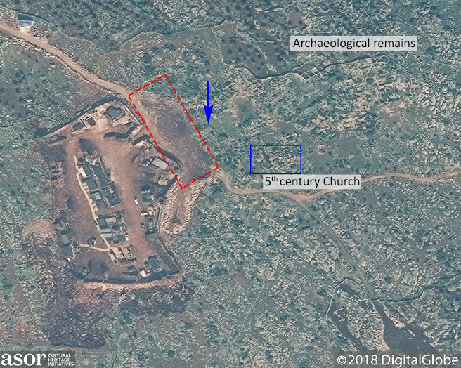
Satellite imagery indicates bulldozing near, and encroachment on the archaeological site of Tekla.
* This report is based on research conducted by the “Safeguarding the Heritage of the Near East Initiative,” funded by the US Department of State. Monthly reports reflect reporting from a variety of sources and may contain unverified material. As such, they should be treated as preliminary and subject to change.

A map of the archaeological features of Tekla and the surrounding area (Tchalenko, Villages II, Pl. LXIV)
Tekla (تكلا), one of the Byzantine Dead Cities inscribed on the UNESCO World Heritage List in 2011, has never been formally excavated [1]. However, identified buildings at the site include the remains of several villas, olive presses, cisterns, and stables.
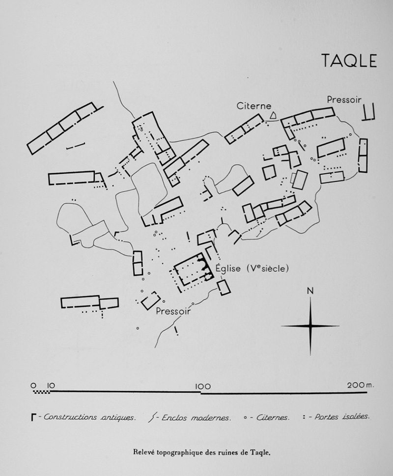
A diagram of the archaeological features at Tekla (Tchalenko, Villages II, Pl. LXV)

Photographs taken ca. 1900 of the 5th-century church at Tekla and other remains (Tchalenko, Villages II, Pl. CLXXIX)
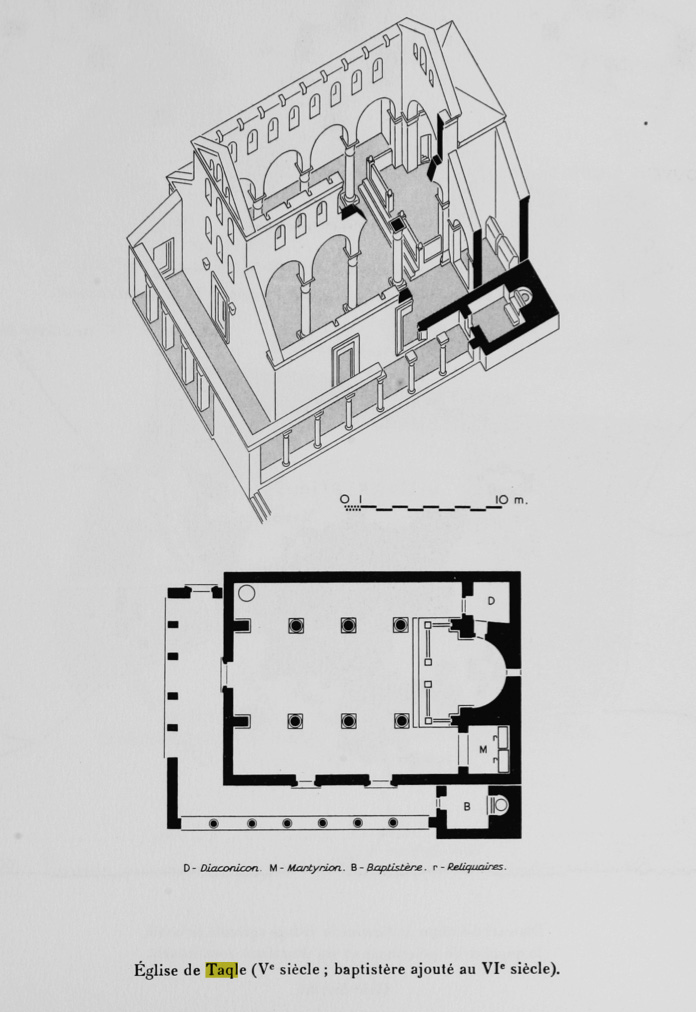
A diagram of the 5th-century church at Tekla (Tchalenko Villages II, Pl. LXVI)
In October 2017, reports emerged that the Turkish army was building an army outpost near the site of Deir Semaan. Video footage published by al-Dahar al-Shamiya (now removed) revealed the location of the outpost to be adjacent to Tekla. In the video, heavy machinery is seen being used near the western facade of the 5th-century church.
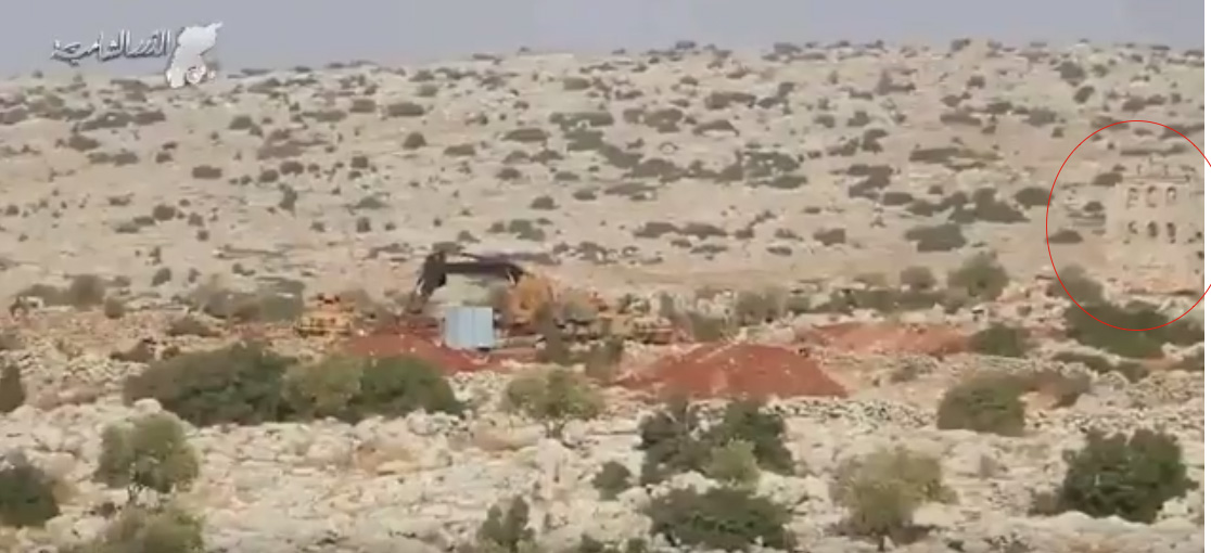
A video still from the video published by al-Dahar al-Shamiya (now removed) shows excavators in use at the site of Tekla, with the facade of the 5th-century church circled in red (Al-Dahar al-Shamiya; October 24, 2017)
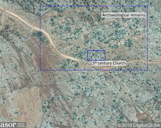
The location of Tekla is shown within the blue rectangle, prior to damage from military construction (DigitalGlobe NextView License; September 29, 2017)
Between November 9, 2017 and January 22, 2018 there was significant bulldozing along the modern road near Tekla, damaging several features of the archaeological area. There is visible construction and activity on the base in the most recently available imagery from February 10, 2018. Recent construction appears to have affected an ancient olive press, as well as several unidentified ancient structures along the western edge of the site.
