
INCIDENT REPORT FEATURE: TAL AFAR CITADEL
U. S. DEPT. COOPERATION AGREEMENT NUMBER: S-IZ-100-17-CA021
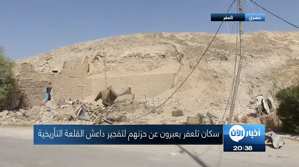
New video footage shows the condition of the Tal Afar Citadel.
* This report is based on research conducted by the “Safeguarding the Heritage of the Near East Initiative,” funded by the US Department of State. Monthly reports reflect reporting from a variety of sources and may contain unverified material. As such, they should be treated as preliminary and subject to change.

The Citadel of Tal Afar is an Ottoman-era fortification in the center of the largely Turkmen town of Tal Afar. The city may be a Late Assyrian Period foundation based on the similarity of Tal Afar to the toponym Thela’sar, which appears in the Bible (Kings 19:12 and Isaiah 37:12) [1]. According to the Oxford Archaeology Image Database, however, no excavations have yet been conducted at Tal Afar and this identification is uncertain. The current fortification largely dates to the Ottoman period.
According to Dr. Trevor Watkins, who led a rescue excavation at nearby Qermez Dere in the late 1980s, the citadel at that time was managed by the Directorate-General of Antiquities and housed a small museum which was not open to the public. The Directorate-General restored about half of the citadel ramparts in the 1970s and 80s, but modern construction had encroached on the rest of the site. The citadel was used as the headquarters of the Tal Afar municipal council and local police after the 2003 US invasion of Iraq.
ISIS militants captured Tal Afar a week after taking Mosul and Tikrit in June 2014, following a two-day battle with Iraqi security forces. ISIS began destroying cultural heritage sites in the town almost immediately. By July 4, 2016, ISIS militants had intentionally damaged or destroyed multiple Shia sites in the city (as confirmed by DigitalGlobe satellite imagery), including the Mosque of Imam Sa’ad ibn Aqil ibn Abi Talib, the Mosque of the Martyrs of Lashkar-e Mulla, the Mosque of Sheikh Mohammad Taqi al-Mawla, the Mosque of Mulla Mahmoud, an unidentified mosque, the Mosque of Hashim Antr, the Mosque of Imam al-Sadiq, the Mosque of al-Abbas, the Mosque of Ahl Beit, the Mosque of Sheikh Jawad al-Sadiq, and the Shrine of Khidr al-Elias (see see ASOR CHI Incident Reports IHI 15-001, IHI 15-002, IHI 15-003, IHI 15-004, IHI 15-006, IHI 15-008, IHI 15-009, IHI 15-010, IHI 15-011, IHI 15-013 in Weekly Report 30).
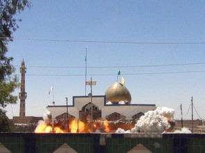
A video still from footage of the deliberate destruction of the Mosque of Imam Sa’ad ibn Aqil ibn Abi Talib, published by a now disabled ISIS Twitter account.
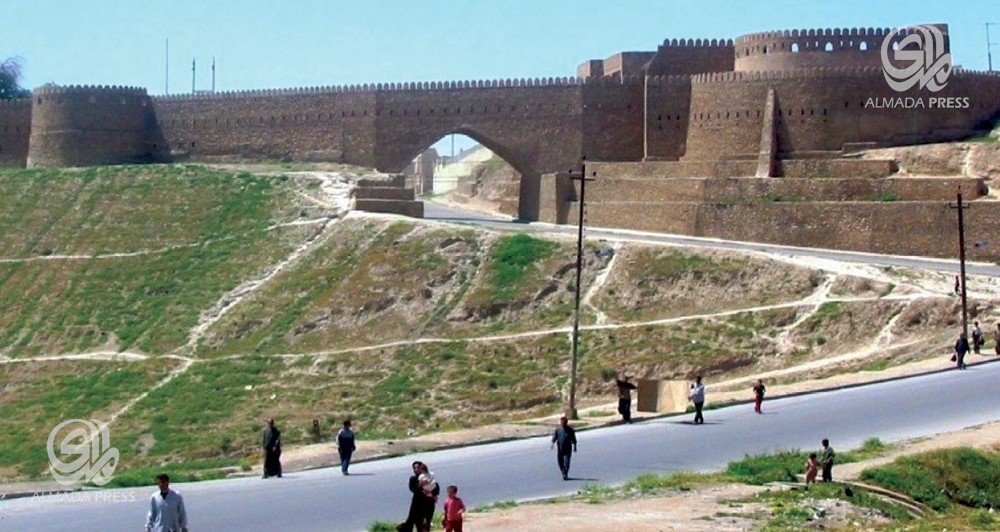
The northern Citadel walls are seen in a pre-damage photograph (Almada Press; June 16, 2014)
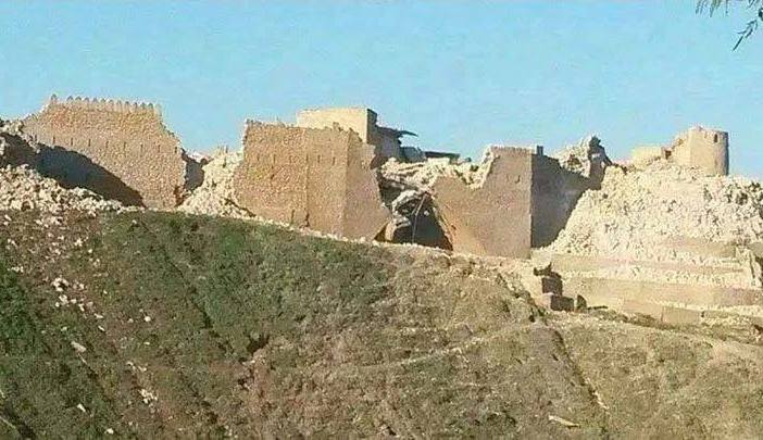
Severe damage to the northern Citadel walls following their intentional destruction by ISIS militants (Gates of Nineveh; February 10, 2015)
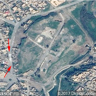
Though no new damage to the site was reported by the media, DigitalGlobe satellite imagery shows that the Citadel suffered further damage from February to April 2017.
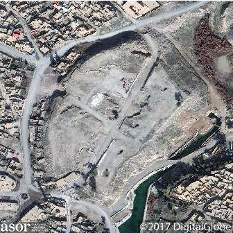
Satellite imagery of the Citadel in early February 2017, prior to increased damage. (DigitalGlobe NextView License; February 6, 2017)
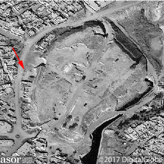
Increased damage to the western edge of the site in late February, likely from the use of heavy machinery. (DigitalGlobe NextView License; February 23, 2017)
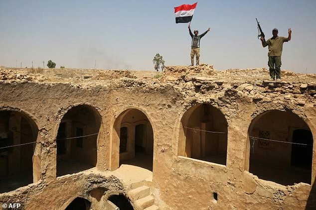
PMU fighters raise the Iraqi flag on the Citadel (France 24; August 28, 2017)
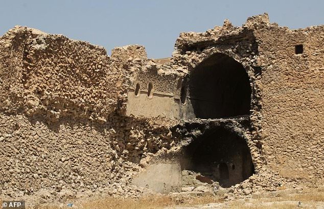
Partially detonated section of Citadel walls (The Daily Mail; August 28, 2017)
On October 4, 2017 al-Aan Arabic Television published extensive video footage of the Citadel. This includes new imagery of the lower western side of the hill, where ISIS militants reportedly bulldozed modern buildings and used earthmoving equipment in an attempt to loot the site. DigitalGlobe satellite images included above indicates that the damage from looting extends along much of the the northwestern slope of the Citadel.
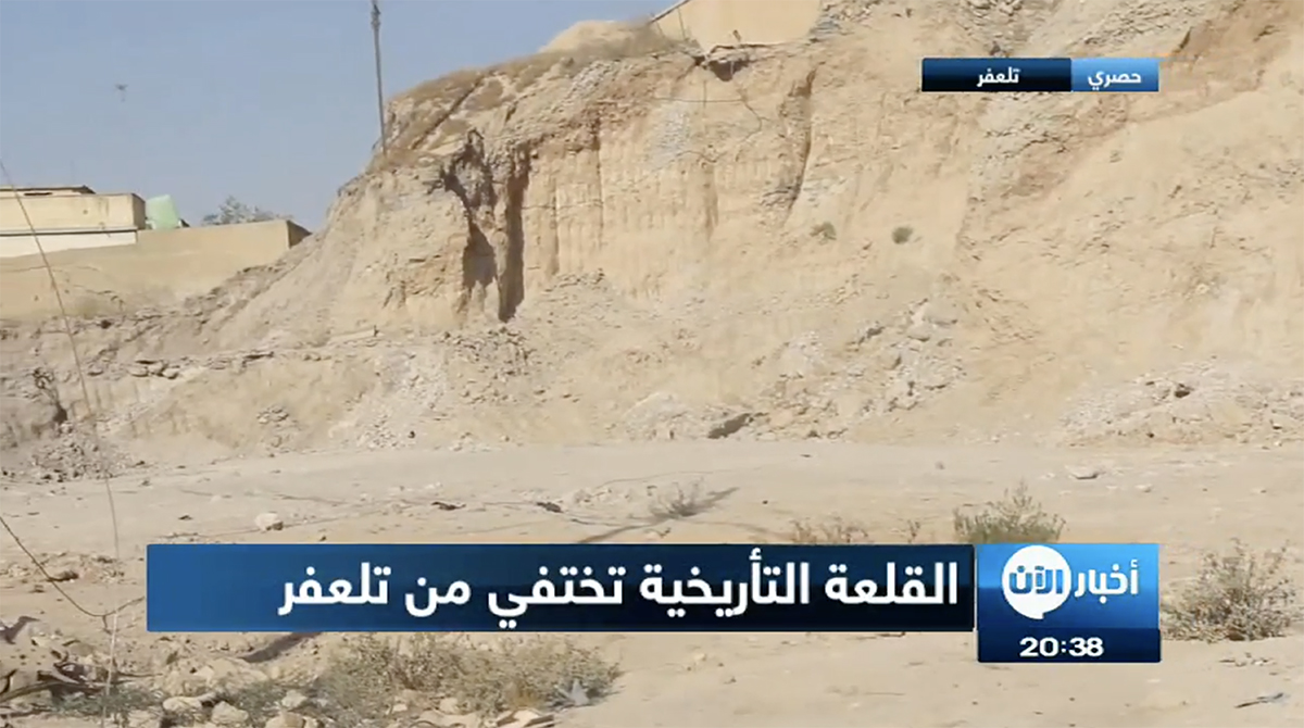
Video still of southwestern section of Citadel, where ISIS militants looted the site using earthmoving equipment (Al-Aan Arabic Television; October 4, 2017)
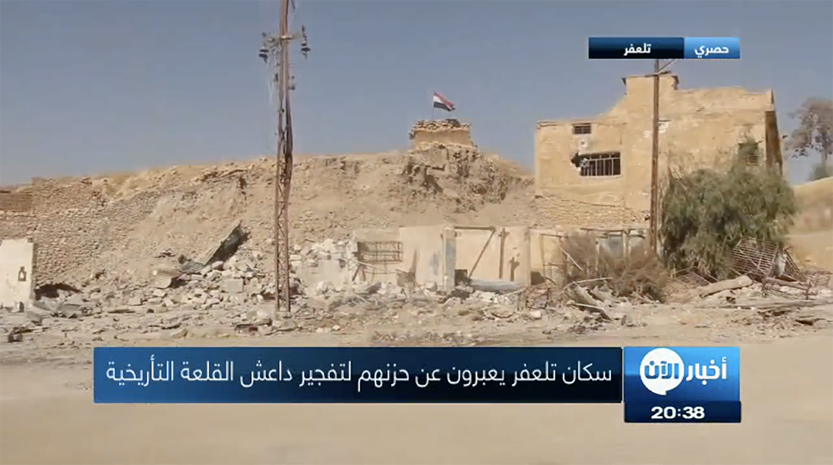
Video still of damage to buildings around lower western section of Citadel, as well as piles of building material from destroyed structures formerly on top of the mound. (Al-Aan Arabic Television; October 4, 2017)
