

HOW WE WORK
INVENTORY
The ASOR CHI inventory includes thousands of archaeological sites and monuments, from prehistoric cave sites and small mounds representing the world’s earliest settled farming communities to the enormous mounded complexes of humanity’s earliest known cities such as Ugarit, Ebla, Mari, Aleppo, and Nimrud. The inventory contains an impressive array of monumental urban centers and monuments of the Hellenistic, Roman, Byzantine, and Islamic eras, including Palmyra, Hatra, Mosul, Krak des Chevalier, and Damascus as well as myriad other sites that await scientific study. Religious sites and monuments comprise the second largest part of the inventory and include ancient rock carvings and ziggurats from remote antiquity to mosques, shrines, synagogues, temples, churches, and cemeteries that span the periods from the birth of many major religions to the modern era. We have also inventoried secular sites and monuments — for example, historic government buildings, sporting centers, water wheels, parks, and statues — along with the administrative infrastructure and cultural repositories that form the core of the region’s educational and cultural heritage infrastructures, including a wealth of museums, collections, libraries, and archives. While our inventory entries generally document a single site or monument, we have also adopted a multiscalar approach that incorporates historic districts, neighborhoods, villages, and cities.
This inventory was compiled with the assistance of multiple research groups around the world and through diverse published surveys. While the inventory continues to grow, its coverage and accuracy depend on collaboration with other experts in the various regions of the Middle East. ASOR CHI also works to catalogue ongoing damage through high-resolution satellite imagery, incident reports published in our weekly reports, photographs and videos made available online, news and social media reports, and overall assessment of site condition using all of these data sources.
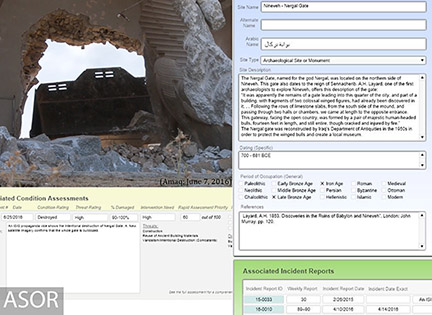
Over the last two years, ASOR CHI has inventoried 13,000 cultural heritage sites in Syria and northern Iraq. The inventory includes a wide range of different site types, such as archaeological, religious, and secular sites as well as museums, libraries, and historic districts.
IN-COUNTRY DOCUMENTATION
ASOR CHI obtains data on cultural heritage incidents from individuals and organizations working within or on the borders of the conflict zones of Syria and northern Iraq. This data is incorporated into our Incident Reports and published in our ongoing Weekly Report series. Such information helps to ensure that ASOR CHI provides timely and accurate information that helps to expose atrocities such as cultural cleansing and religious persecution, thwart the efforts of antiquities smugglers, and counter the propaganda produced by extremist organizations and other belligerents operating in the conflict zones of Syria and Iraq.
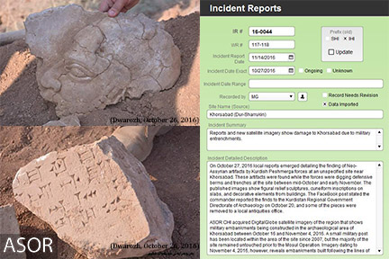
ASOR CHI obtains data on cultural heritage incidents from individuals and organizations working within or on the borders of the conflict zones of Syria and northern Iraq.
CONDITION ASSESSMENTS
Relevant data is gathered using techniques developed by ASOR CHI and other cultural heritage organizations from ground level and low-level aerial photo-documentation, high-resolution satellite imagery, and more intensive ground-based survey assessments. All of this information is compiled by the ASOR CHI Conservation Team into an overall summary of the current known condition of the site. Within that assessment, the conservation team also assesses the ongoing threat to the site and ranks its rapid assessment priority using multiple factors.
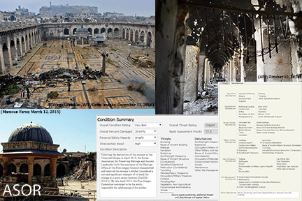
ASOR CHI conducts condition assessments to obtain detailed data on damage, risks, and threats to heritage sites.
SATELLITE ASSESSMENT
The ASOR CHI Geospatial Team assesses and monitors heritage sites using available high resolution satellite images. Each heritage site is often assessed multiple times using multiple images to build a timeline of visible damage. Satellite imagery is important in corroborating ground-based damage reports as well as identifying damage before it is noted in the media.
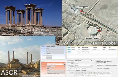
ASOR CHI monitors and assesses damage using high resolution satellite imagery.
MEDIA INDEX
ASOR CHI has created a database of over 10,000 media files related to cultural heritage incidents in the conflict zones of Syria and northern Iraq, including photographs, videos, and video stills. Such media is collected from open-source outlets such as online new stories, blogs, and other web posts as well as individuals on the ground and site assessment teams supported by ASOR CHI. ASOR CHI hopes to expand our media database through the mobile app cultural heritage monitor, where users in northern Iraq and Syria can anonymously share photographs of sites.
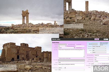
ASOR CHI catalogues photographs and video to assist in documenting damage.
ARCHES
A major activity for 2017-2018 will be the export of large amounts of information from the ASOR CHI database to the ARCHES platform. ASOR CHI is developing the ARCHES system with the Getty Conservation Institute to share data with our in-country partners and with our other partners around the globe using a secure platform for access.
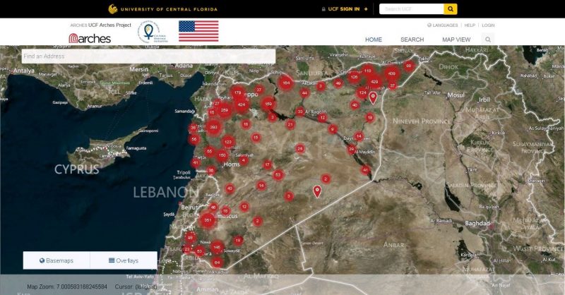
The ARCHES database system will host our data online in 2017-2018.